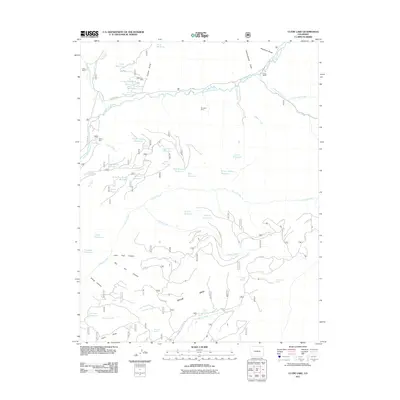
2011 Map of Clyde Lake
USGS Topo · Published 2011About this map
Taylor Mesa dominates the southern portion of this high-elevation landscape, where a complex network of forest roads and drainages reveals a history of water management and mineral extraction. The headwaters of the West Dolores River are joined by several tributaries, including Fish Creek and Stoner Creek, which are supported by numerous catchments such as Clyde Lake Reservoir and Juan Spring Reservoir. Local ranching and mining roots are evident through landmarks like Miller Ranch and the Little Silver Mine.
Find a feature on this map
62 named features on this map. Tap any name to fly to it.
Don’t see what you’re looking for? This feature index may not catch every label — zoom into the map to look around manually.
Map Details
Editions of this 2011 Clyde Lake Map
This is the sole edition of this map. No revisions or reprints were ever made.
Other maps of this area

1897 · Rico
USGS Topo · 1:62,500

1898 · Rico
USGS Topo · 1:62,500

1899 · Rico
USGS Topo · 1:62,500

1953 · Dolores Peak
USGS Topo · 1:24,000

1956 · Cortez
USGS Topo · 1:250,000

1958 · Cortez
USGS Topo · 1:250,000

1959 · Cortez
USGS Topo · 1:250,000
1960 · Rico
USGS Topo · 1:24,000

1962 · Cortez
USGS Topo · 1:250,000

1963 · Stoner
USGS Topo · 1:24,000