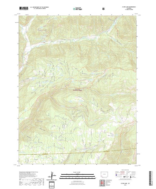
2022 Map of Clyde Lake
USGS Topo · Published 2022About this map
The West Dolores River winds through the northwestern corner of this territory, part of the extensive San Juan National Forest at the boundary of Dolores and Montezuma counties. The landscape is dominated by high plateaus including Stoner Mesa and Taylor Mesa, which are dissected by dramatically named drainages such as Little Hell Canyon, Big Hell Canyon, and Sheep Canyon. This high-country terrain is defined by an intricate network of water management features, notably Clyde Lake Reservoir and its namesake Clyde Lake, alongside numerous smaller catchments like Cresto Spring Reservoir and Pine Spring Reservoir. The prevalence of these named reservoirs and springs, including Soft Water Spring and Camp Spring, suggests a landscape heavily utilized for seasonal grazing and water storage. Historical access is marked by several established routes like the Stoner Mesa Trl and the Stoner Creek Trl, which follow the natural contours of the mesas.
Find a feature on this map
108 named features on this map. Tap any name to fly to it.
Don’t see what you’re looking for? This feature index may not catch every label — zoom into the map to look around manually.
Map Details
Editions of this 2022 Clyde Lake Map
This is the sole edition of this map. No revisions or reprints were ever made.
Other maps of this area

1897 · Rico
USGS Topo · 1:62,500

1898 · Rico
USGS Topo · 1:62,500

1899 · Rico
USGS Topo · 1:62,500

1953 · Dolores Peak
USGS Topo · 1:24,000

1956 · Cortez
USGS Topo · 1:250,000

1958 · Cortez
USGS Topo · 1:250,000

1959 · Cortez
USGS Topo · 1:250,000
1960 · Rico
USGS Topo · 1:24,000

1962 · Cortez
USGS Topo · 1:250,000

1963 · Stoner
USGS Topo · 1:24,000