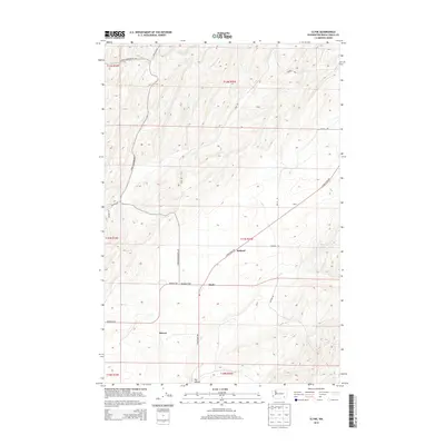
2013 Map of Clyde
USGS Topo · Published 2013About this map
Eureka Flat dominates this portion of Walla Walla County, where the topography of the Columbia Plateau is etched with the drainage of Dry Hollow. The landscape is defined by its agricultural and transportation layout, centered on the small settlement of Clyde and the nearby points of Pickard and Harvey. These locales serve as markers in a region primarily organized by its expansive township and range sections, which are traversed by a network of local thoroughfares such as Lyons Ferry Rd and Babcock Rd.
Find a feature on this map
22 named features on this map. Tap any name to fly to it.
Don’t see what you’re looking for? This feature index may not catch every label — zoom into the map to look around manually.
Map Details
Editions of this 2013 Clyde Map
This is the sole edition of this map. No revisions or reprints were ever made.
Other maps of this area

1915 · Wallulah
USGS Topo · 1:96,000

1916 · Connell
USGS Topo · 1:125,000

1918 · Connell
USGS Topo · 1:125,000

1918 · Wallula
USGS Topo · 1:125,000

1919 · Walla Walla
USGS Topo · 1:125,000

1921 · Walla Walla
USGS Topo · 1:125,000

1948 · Ayer
USGS Topo · 1:62,500

1950 · Haas
USGS Topo · 1:62,500

1953 · Walla Walla
USGS Topo · 1:250,000

1958 · Walla Walla
USGS Topo · 1:250,000