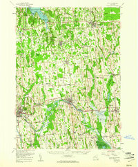
1953 Map of Clyde
USGS Topo · Published 1961About this map
Sodus Bay and the shoreline of Lake Ontario anchor the northern reaches of this Wayne County landscape, where the terrain is defined by a dense concentration of glacial drumlins. To the south, the Clyde River and the Erie Canal corridor serve as the historical spine for trade and transit, connecting the industrial centers of Lyons and Clyde. This 1953 survey captures the region just before significant modern highway expansion, showing a rural economy still tightly linked to the New York Central railroad and a network of named crossroads like Maunders Corners and Stewart Corners. The southern edge is dominated by the Montezuma Marsh and the Montezuma National Wildlife Refuge, where the Seneca River meanders through expansive wetlands. Genealogists will find numerous family-named landmarks and small burial grounds, including the Butler Savannah Cem and the Lock Berlin Cem.
Find a feature on this map
101 named features on this map. Tap any name to fly to it.
Don’t see what you’re looking for? This feature index may not catch every label — zoom into the map to look around manually.
Map Details
Editions of this 1953 Clyde Map
This is the sole edition of this map. No revisions or reprints were ever made.
Other maps of this area

1899 · Auburn
USGS Topo · 1:62,500

1899 · Palmyra
USGS Topo · 1:62,500

1900 · Oswego
USGS Topo · 1:62,500

1902 · Sodus Bay
USGS Topo · 1:62,500

1902 · Pultneyville
USGS Topo · 1:62,500

1902 · Geneva
USGS Topo · 1:62,500

1902 · Clyde
USGS Topo · 1:62,500

1902 · Phelps
USGS Topo · 1:62,500

1902 · Weedsport
USGS Topo · 1:62,500

1902 · Auburn
USGS Topo · 1:62,500