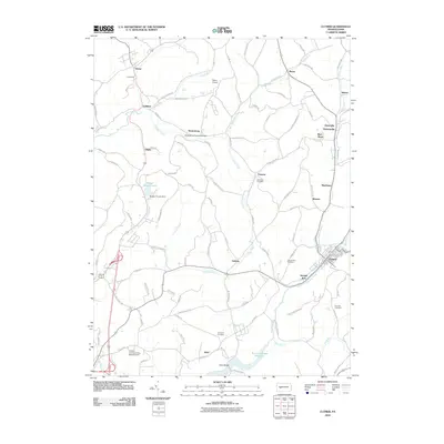
2010 Map of Clymer
USGS Topo · Published 2010About this map
Crooked Creek and Two Lick Creek define the drainage and settlement patterns of this section of Indiana County, where agricultural valleys meet the industrial heritage of western Pennsylvania. The Kintersburg Covered Bridge stands as a landmark of nineteenth-century engineering near the small cluster of Kintersburg. To the southeast, the larger community of Clymer is situated at the confluence of several runs, including Buck Run, while smaller hamlets like Barr Slope, Sample Run, and Ideal dot the landscape. The infrastructure of the early twenty-first century is evident at the Indiana County/Jimmy Stewart Field and the Two Lick Creek Reservoir. For the local historian, the map preserves the locations of numerous family-named landmarks and rural burial grounds such as Columbia Cemetery and Rich Hill Cemetery, alongside specialized sites like the Musser Forests Lake.
Find a feature on this map
100 named features on this map. Tap any name to fly to it.
Don’t see what you’re looking for? This feature index may not catch every label — zoom into the map to look around manually.
Map Details
Editions of this 2010 Clymer Map
This is the sole edition of this map. No revisions or reprints were ever made.
Other maps of this area

1902 · Indiana
USGS Topo · 1:62,500

1902 · Barnesboro
USGS Topo · 1:62,500

1904 · Barnesboro
USGS Topo · 1:62,500

1906 · Punxsutawney
USGS Topo · 1:62,500

1909 · Smicksburg
USGS Topo · 1:62,500

1938 · Smicksburg
USGS Topo · 1:62,500

1939 · Smicksburg
USGS Topo · 1:62,500

1939 · Punxsutawney
USGS Topo · 1:62,500

1942 · Punxsutawney
USGS Topo · 1:62,500

1943 · Punxsutawney
USGS Topo · 1:125,000
Featured Places
- Rayne Township, PA
- Clymer, PA
- Dixonville, Green Township
- Weimer, Cherryhill Township
- Gaiblton, Rayne Township