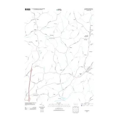
2013 Map of Clymer
USGS Topo · Published 2013About this map
Clymer serves as a primary hub within this rural Indiana County landscape, where the town layout meets the waters of Two Lick Creek. The area is defined by a dense network of small villages and hamlets, including Sample Run, Dixonville, and Kintersburg, many of which developed around the local mining and agricultural traditions of western Pennsylvania. A notable cultural landmark is the Kintersburg Covered Bridge, which spans Crooked Creek north of the village. Aviation history is also represented by the Indiana County Airport, named for the famous actor and local native. The terrain is intricately carved by numerous waterways such as Dixon Run and McKee Run, creating a patchwork of small ridges and valleys that have historically shaped the roads and settlement patterns of townships like Rayne and Cherryhill.
Find a feature on this map
118 named features on this map. Tap any name to fly to it.
Don’t see what you’re looking for? This feature index may not catch every label — zoom into the map to look around manually.
Map Details
Editions of this 2013 Clymer Map
This is the sole edition of this map. No revisions or reprints were ever made.
Other maps of this area

1902 · Indiana
USGS Topo · 1:62,500

1902 · Barnesboro
USGS Topo · 1:62,500

1904 · Barnesboro
USGS Topo · 1:62,500

1906 · Punxsutawney
USGS Topo · 1:62,500

1909 · Smicksburg
USGS Topo · 1:62,500

1938 · Smicksburg
USGS Topo · 1:62,500

1939 · Smicksburg
USGS Topo · 1:62,500

1939 · Punxsutawney
USGS Topo · 1:62,500

1942 · Punxsutawney
USGS Topo · 1:62,500

1943 · Punxsutawney
USGS Topo · 1:125,000
Featured Places
- Rayne Township, PA
- Clymer, PA
- Dixonville, Green Township
- Weimer, Cherryhill Township
- Gaiblton, Rayne Township