2023 Map of Clymer
USGS Topo · Published 2023About this map
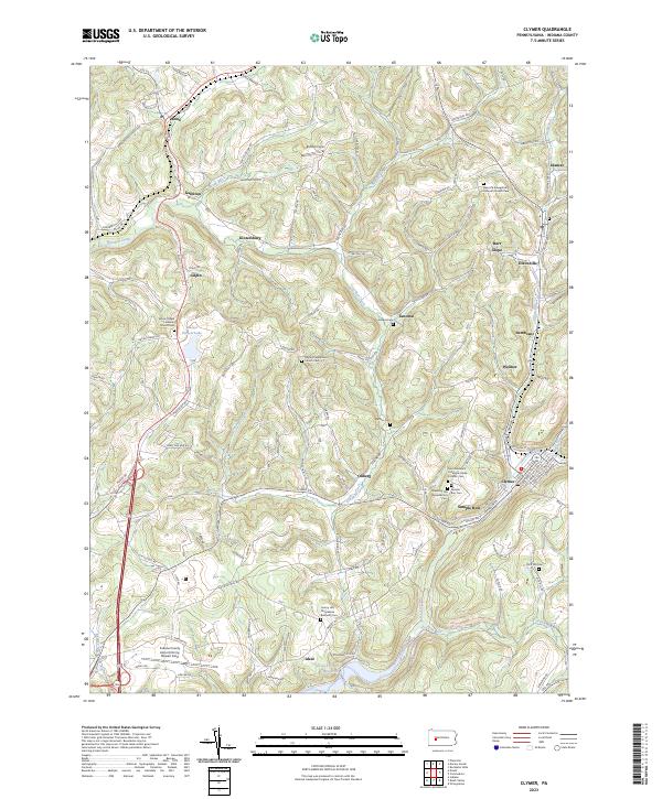
Clymer and the surrounding Indiana County countryside are defined by a complex network of winding watercourses and small ridge-top settlements. The landscape follows the flow of Two Lick Creek and Crooked Creek, which carve deep valleys between the highlands where towns like Kintersburg, Gilpin, and Tanoma are situated. Near the southern edge, the Two Lick Creek Reservoir provides a significant water feature, while the Indiana County Airport/Jimmy Stewart Field serves as a prominent modern landmark near Ideal.
Find a feature on this map
105 named features on this map. Tap any name to fly to it.
Don’t see what you’re looking for? This feature index may not catch every label — zoom into the map to look around manually.
Map Details
Editions of this 2023 Clymer Map
This is the sole edition of this map. No revisions or reprints were ever made.