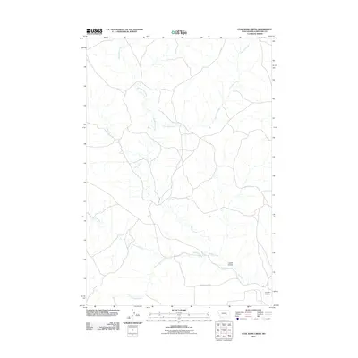
2011 Map of Coal Bank Creek
USGS Topo · Published 2011About this map
Coal Bank Creek and the branching waters of the Buffalo Creek drainage dominate this section of Yellowstone County. The landscape is defined by the dendritic patterns of East Buffalo Creek and Antelope Creek, illustrating the natural drainage toward the southeast. Land use is largely reflected in the sparse road network, with Seven Mile Flat Rd providing primary access through the open range.
Find a feature on this map
8 named features on this map. Tap any name to fly to it.
Don’t see what you’re looking for? This feature index may not catch every label — zoom into the map to look around manually.
Map Details
Editions of this 2011 Coal Bank Creek Map
This is the sole edition of this map. No revisions or reprints were ever made.
Other maps of this area

1954 · Forsyth
USGS Topo · 1:250,000

1957 · Forsyth
USGS Topo · 1:250,000

1958 · Forsyth
USGS Topo · 1:250,000

1960 · Coal Bank Creek
USGS Topo · 1:24,000

1960 · Custer
USGS Topo · 1:24,000

1960 · Waco
USGS Topo · 1:24,000
1960 · Mission Creek
USGS Topo · 1:24,000
1967 · Bull Mountain
USGS Topo · 1:24,000

1979 · Hysham
USGS Topo · 1:100,000
1979 · Devils Kitchen
USGS Topo · 1:24,000