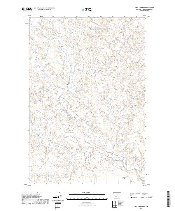
2024 Map of Coal Bank Creek
USGS Topo · Published 2024About this map
Sevenmile Flat defines the southern portion of this Yellowstone County landscape, where the high plains are carved by a complex network of coulees and seasonal drainages. The area is dominated by the namesake Coal Bank Creek and the bifurcated flows of East Buffalo Creek and Buffalo Creek, which illustrate the characteristic erosional patterns of the Montana prairie. This 2024 map documents the remote road network essential to local ranching and land management, specifically the primary artery of Custer Pineview Rd and the access provided by Buffalo Creek Road. Between the distinct elevations of Laylan Coulee and Carson Coulee, the map reveals how township and range lines like t5n r32e organize this expansive terrain into a functional grid for contemporary land use and surveying.
Find a feature on this map
18 named features on this map. Tap any name to fly to it.
Don’t see what you’re looking for? This feature index may not catch every label — zoom into the map to look around manually.
Map Details
Editions of this 2024 Coal Bank Creek Map
This is the sole edition of this map. No revisions or reprints were ever made.
Other maps of this area

1954 · Forsyth
USGS Topo · 1:250,000

1957 · Forsyth
USGS Topo · 1:250,000

1958 · Forsyth
USGS Topo · 1:250,000

1960 · Coal Bank Creek
USGS Topo · 1:24,000

1960 · Custer
USGS Topo · 1:24,000

1960 · Waco
USGS Topo · 1:24,000
1960 · Mission Creek
USGS Topo · 1:24,000
1967 · Bull Mountain
USGS Topo · 1:24,000

1979 · Hysham
USGS Topo · 1:100,000
1979 · Devils Kitchen
USGS Topo · 1:24,000