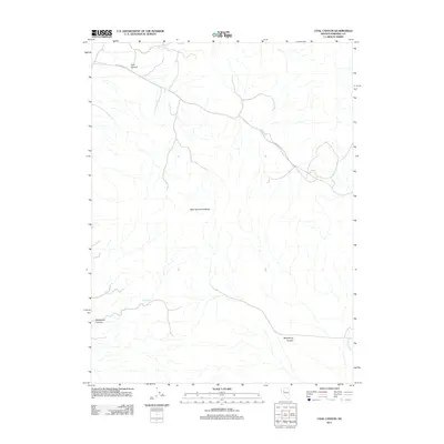
2011 Map of Coal Canyon
USGS Topo · Published 2011About this map
The West Humboldt Range dominates this Pershing County landscape, defined by high-elevation drainage systems and isolated water sources. As recorded in 2011, the area is characterized by deep topographical relief and significant natural features such as Muttlebury Canyon and Coal Canyon. A single primary route, Coal Canyon Rd, provides access into the interior, tracing the floor of its namesake canyon in the northwest. The presence of Muckleberry Spring indicates a vital perennial water source in an otherwise arid environment, while Packard Wash serves as a major drainage in the southeast. This survey reflects the sparse, utilitarian nature of the high desert, where naming conventions are strictly tied to the terrain and its few accessible landmarks.
Find a feature on this map
6 named features on this map. Tap any name to fly to it.
Don’t see what you’re looking for? This feature index may not catch every label — zoom into the map to look around manually.
Map Details
Editions of this 2011 Coal Canyon Map
This is the sole edition of this map. No revisions or reprints were ever made.
Other maps of this area

1931 · Lovelock
USGS Topo · 1:250,000

1935 · Lovelock
USGS Topo · 1:250,000

1954 · Unionville
USGS Topo · 1:62,500

1954 · Buffalo Mtn
USGS Topo · 1:62,500

1955 · Lovelock
USGS Topo · 1:250,000

1956 · Oreana
USGS Topo · 1:62,500

1956 · Lovelock
USGS Topo · 1:62,500

1959 · Lovelock
USGS Topo · 1:250,000

1984 · Lovelock
USGS Topo · 1:100,000
1987 · Buffalo Mountain
USGS Topo · 1:24,000