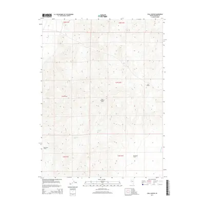
2014 Map of Coal Canyon
USGS Topo · Published 2014About this map
The West Humboldt Range dominates this portion of Pershing County, where high ridges and deep canyons define the arid landscape. The map records several notable drainage and water features that are vital in this high-desert environment, including the isolated Muckleberry Spring located in the western foothills. The rugged topography is further carved by Coal Canyon and Muttlebury Canyon, which drain the eastern slopes toward the Packard Wash. These features reflect a classic Great Basin geological profile, characterized by steep elevation changes and ephemeral water sources that have historically influenced movement and settlement in this part of Nevada. While largely undeveloped, the township and range lines indicate a structured grid system overlying the complex natural terrain, including boundaries for t27n r33e and t26n r32e.
Find a feature on this map
11 named features on this map. Tap any name to fly to it.
Don’t see what you’re looking for? This feature index may not catch every label — zoom into the map to look around manually.
Map Details
Editions of this 2014 Coal Canyon Map
This is the sole edition of this map. No revisions or reprints were ever made.
Other maps of this area

1931 · Lovelock
USGS Topo · 1:250,000

1935 · Lovelock
USGS Topo · 1:250,000

1954 · Unionville
USGS Topo · 1:62,500

1954 · Buffalo Mtn
USGS Topo · 1:62,500

1955 · Lovelock
USGS Topo · 1:250,000

1956 · Oreana
USGS Topo · 1:62,500

1956 · Lovelock
USGS Topo · 1:62,500

1959 · Lovelock
USGS Topo · 1:250,000

1984 · Lovelock
USGS Topo · 1:100,000
1987 · Buffalo Mountain
USGS Topo · 1:24,000