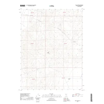
2018 Map of Coal Canyon
USGS Topo · Published 2018About this map
West Humboldt Range dominates this Pershing County landscape, defined by steep ridges and the dry drainages of the high desert. The map captures a high-elevation network of canyons and springs that have historically sustained travel and localized industry in this arid environment. Significant water sources like Muttlebury Spring and Muckleberry Spring are documented, providing critical points of reference in a terrain where water is scarce. The geography is etched with deep cuts such as Coal Canyon and Muttlebury Canyon, which dictate the paths of unpaved transit routes like Coal Canyon Rd and the Coal Canyon-Stillwater Rd. This 2018 survey by the U.S. Geological Survey details the rugged topography and the natural drainage patterns, including Packard Wash, illustrating the harsh but navigated character of the Nevada interior.
Find a feature on this map
14 named features on this map. Tap any name to fly to it.
Don’t see what you’re looking for? This feature index may not catch every label — zoom into the map to look around manually.
Map Details
Editions of this 2018 Coal Canyon Map
This is the sole edition of this map. No revisions or reprints were ever made.
Other maps of this area

1931 · Lovelock
USGS Topo · 1:250,000

1935 · Lovelock
USGS Topo · 1:250,000

1954 · Unionville
USGS Topo · 1:62,500

1954 · Buffalo Mtn
USGS Topo · 1:62,500

1955 · Lovelock
USGS Topo · 1:250,000

1956 · Oreana
USGS Topo · 1:62,500

1956 · Lovelock
USGS Topo · 1:62,500

1959 · Lovelock
USGS Topo · 1:250,000

1984 · Lovelock
USGS Topo · 1:100,000
1987 · Buffalo Mountain
USGS Topo · 1:24,000