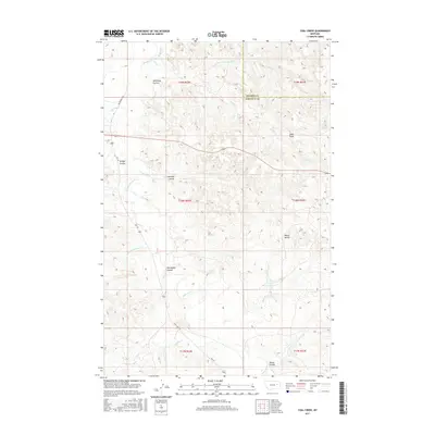
2017 Map of Coal Creek
USGS Topo · Published 2017About this map
White Buttes and Hook Rock rise above the drainage networks of the Big Dry Creek basin in this part of eastern Montana. The landscape is heavily defined by its complex coulee systems, which have served as traditional landmarks and grazing corridors for generations of ranchers. Significant seasonal waterways including Coal Creek, Little Dry Creek, and Big Wild Horse Creek carve the terrain, illustrating the intricate hydrography that dictates the placement of rural roads like Van Norman Rd and Vall Rd.
Find a feature on this map
25 named features on this map. Tap any name to fly to it.
Don’t see what you’re looking for? This feature index may not catch every label — zoom into the map to look around manually.
Map Details
Editions of this 2017 Coal Creek Map
This is the sole edition of this map. No revisions or reprints were ever made.
Other maps of this area

1954 · Jordan
USGS Topo · 1:250,000

1956 · Jordan
USGS Topo · 1:250,000

1958 · Jordan
USGS Topo · 1:250,000

1964 · Jordan
USGS Topo · 1:250,000

1965 · Whiteside Ranch
USGS Topo · 1:24,000

1965 · Hedstrom Lake NW
USGS Topo · 1:24,000

1965 · Hafla School
USGS Topo · 1:24,000

1967 · Hagen Gap
USGS Topo · 1:24,000
1967 · Maxwell Coulee
USGS Topo · 1:24,000

1967 · Coal Creek
USGS Topo · 1:24,000