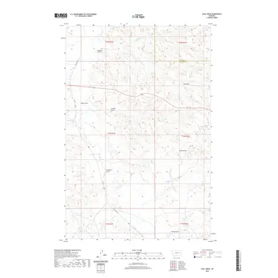
2020 Map of Coal Creek
USGS Topo · Published 2020About this map
The border of McCone and Garfield Counties runs through this sparsely populated stretch of Big Sky country, dominated by an intricate drainage system of coulees and seasonal creeks. The landscape is defined by the erosion-carved terrain surrounding Coal Creek and the Prong Coal Creek, where named features like Hook Rock and White Buttes serve as prominent landmarks in the high plains. The map reveals the ranching-ready geography of the early 21st century, showing how modern transportation routes like State Highway 462 and Vall Road navigate the complex network of draws including Norwegian Coulee, Calamity Coulee, and Bridge Coulee. While few permanent settlements are noted, the density of named waterways—from Big Wild Horse Creek to Spring Creek—highlights the vital role of water management and geography in this arid landscape.
Find a feature on this map
25 named features on this map. Tap any name to fly to it.
Don’t see what you’re looking for? This feature index may not catch every label — zoom into the map to look around manually.
Map Details
Editions of this 2020 Coal Creek Map
This is the sole edition of this map. No revisions or reprints were ever made.
Other maps of this area

1954 · Jordan
USGS Topo · 1:250,000

1956 · Jordan
USGS Topo · 1:250,000

1958 · Jordan
USGS Topo · 1:250,000

1964 · Jordan
USGS Topo · 1:250,000

1965 · Whiteside Ranch
USGS Topo · 1:24,000

1965 · Hedstrom Lake NW
USGS Topo · 1:24,000

1965 · Hafla School
USGS Topo · 1:24,000

1967 · Hagen Gap
USGS Topo · 1:24,000
1967 · Maxwell Coulee
USGS Topo · 1:24,000

1967 · Coal Creek
USGS Topo · 1:24,000