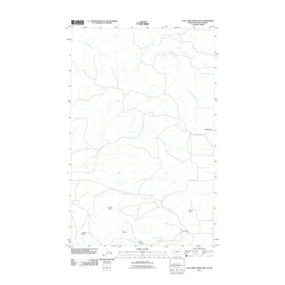
2011 Map of Coal Mine Creek East
USGS Topo · Published 2011About this map
Roanwood sits near the eastern edge of this northern Montana landscape, where the high plains break into a series of coulees and hills. The geography is defined by drainage patterns that flow through rugged breaks, notably Coal Mine Creek and its namesake Coal Mine Hill in the southeast. These names hint at the coal-bearing geography found throughout the region, while landmarks like Opheim Hills and the prominent Round Butte provided essential orientation for early travel across the open range.
Find a feature on this map
15 named features on this map. Tap any name to fly to it.
Don’t see what you’re looking for? This feature index may not catch every label — zoom into the map to look around manually.
Map Details
Editions of this 2011 Coal Mine Creek East Map
This is the sole edition of this map. No revisions or reprints were ever made.
Other maps of this area

1919 · Boundary
USGS Topo · 1:125,000

1954 · Glasgow
USGS Topo · 1:250,000

1957 · Glasgow
USGS Topo · 1:250,000

1958 · Glasgow
USGS Topo · 1:250,000

1973 · Opheim
USGS Topo · 1:24,000

1973 · Roanwood
USGS Topo · 1:24,000

1984 · O'Juel Lake
USGS Topo · 1:24,000

1984 · Opheim
USGS Topo · 1:100,000

1984 · Dodge Reservoir
USGS Topo · 1:24,000
1984 · Coal Mine Creek East
USGS Topo · 1:24,000