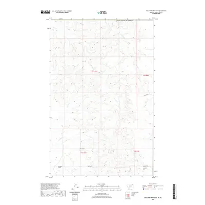
2020 Map of Coal Mine Creek East
USGS Topo · Published 2020About this map
Round Butte and the Opheim Hills dominate this high-plains landscape in Valley County, where the topography is defined by deeply carved coulees and drainage networks near the international boundary. The southern portion of the map is marked by Coal Mine Hill, rising above the drainage of Coal Mine Creek. This area illustrates a typical northern Montana drainage pattern, with Slaughter Coulee and Fox Coulee feeding into larger systems like S Creek and its tributary, North Fork S Creek. The transition from the flat upper benches to the dissected breaks along Morgan Creek in the north highlights the natural erosion patterns of the Missouri River Basin. Human presence is sparse, indicated primarily by the section lines of the Public Land Survey System and local connectors like Richardson Road.
Find a feature on this map
15 named features on this map. Tap any name to fly to it.
Don’t see what you’re looking for? This feature index may not catch every label — zoom into the map to look around manually.
Map Details
Editions of this 2020 Coal Mine Creek East Map
This is the sole edition of this map. No revisions or reprints were ever made.
Other maps of this area

1919 · Boundary
USGS Topo · 1:125,000

1954 · Glasgow
USGS Topo · 1:250,000

1957 · Glasgow
USGS Topo · 1:250,000

1958 · Glasgow
USGS Topo · 1:250,000

1973 · Opheim
USGS Topo · 1:24,000

1973 · Roanwood
USGS Topo · 1:24,000

1984 · O'Juel Lake
USGS Topo · 1:24,000

1984 · Opheim
USGS Topo · 1:100,000

1984 · Dodge Reservoir
USGS Topo · 1:24,000
1984 · Coal Mine Creek East
USGS Topo · 1:24,000