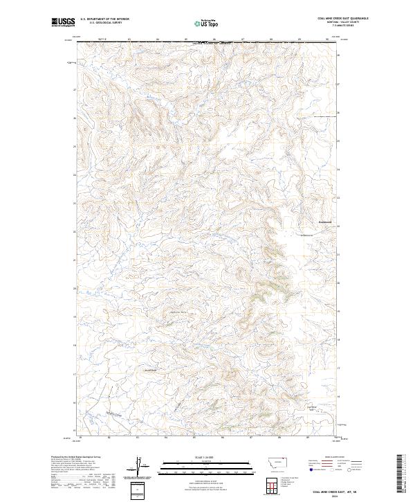
2024 Map of Coal Mine Creek East
USGS Topo · Published 2024About this map
Roanwood sits as a primary point of reference in this corner of Valley County, where the high northern plains transition into the deeply dissected drainages of the Opheim Hills. The landscape is defined by the headwaters of several drainages, including Morgan Creek flowing north and the winding path of Coal Mine Creek in the southern reaches. These watercourses have carved distinct topographic features such as Slaughter Coulee and Fox Coulee, which contrast with prominent elevations like Round Butte.
Find a feature on this map
16 named features on this map. Tap any name to fly to it.
Don’t see what you’re looking for? This feature index may not catch every label — zoom into the map to look around manually.
Map Details
Editions of this 2024 Coal Mine Creek East Map
This is the sole edition of this map. No revisions or reprints were ever made.
Other maps of this area

1919 · Boundary
USGS Topo · 1:125,000

1954 · Glasgow
USGS Topo · 1:250,000

1957 · Glasgow
USGS Topo · 1:250,000

1958 · Glasgow
USGS Topo · 1:250,000

1973 · Opheim
USGS Topo · 1:24,000

1973 · Roanwood
USGS Topo · 1:24,000

1984 · O'Juel Lake
USGS Topo · 1:24,000

1984 · Opheim
USGS Topo · 1:100,000

1984 · Dodge Reservoir
USGS Topo · 1:24,000
1984 · Coal Mine Creek East
USGS Topo · 1:24,000