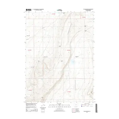
2015 Map of Coal Mine Ridge
USGS Topo · Published 2015About this map
Coal Mine Ridge and the Atlantic Rim define the central landscape of this Carbon County region, where the terrain transitions through a series of canyons and draws. This 2015 survey provides a modern look at the high-desert topography, showing the path of the Continental Divide National Scenic Trail as it winds north toward Hogback Lake. The map reveals a land shaped by scarce water sources and historical resource extraction, evidenced by features like Coal Mine Draw and isolated water points such as Chicken Pete Spring and Ninemile Spring. While largely open country, the drainage patterns of Sugar Cr and the presence of Eightmile Lake illustrate the vital network of basins and canyons, including Robinson Canyon and Bull Canyon, that characterize this part of Wyoming's interior.
Find a feature on this map
26 named features on this map. Tap any name to fly to it.
Don’t see what you’re looking for? This feature index may not catch every label — zoom into the map to look around manually.
Map Details
Editions of this 2015 Coal Mine Ridge Map
This is the sole edition of this map. No revisions or reprints were ever made.
Other maps of this area

1953 · Rawlins
USGS Topo · 1:24,000

1954 · Rawlins
USGS Topo · 1:250,000

1956 · Rawlins Peak
USGS Topo · 1:62,500

1956 · Bridger Pass
USGS Topo · 1:62,500

1956 · Bolten Ranch
USGS Topo · 1:62,500

1958 · Rawlins
USGS Topo · 1:250,000

1962 · Rawlins
USGS Topo · 1:250,000

1967 · Rawlins
USGS Topo · 1:250,000
1983 · Coal Mine Ridge
USGS Topo · 1:24,000
1983 · Separation Peak
USGS Topo · 1:24,000