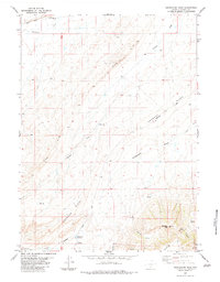
1983 Map of Separation Peak
USGS Topo · Published 1983About this map
Separation Peak rises as the primary landmark in this high-desert region of Carbon County, where the stark topography is defined by the sweeping Red Rim and the parallel line of Hogback Ridge. The 1983 survey documents a landscape of essential water resources and industrial transit, including the Sixteenmile Reservoir and various isolated water sources such as Garza Spring and the seasonal Separation Creek. The presence of the Pacific Pipeline and Twentymile Road highlights the area's role in regional infrastructure, while numerous named drainages like Sixteenmile Draw and Hadsell Draw illustrate the complex watershed of the Wyoming basin. Geological exploration is evident through mapped features such as a Drill Hole and the intricate network of canyons including Ram Canyon and Beckman Canyon that cut through the ridges.
Find a feature on this map
26 named features on this map. Tap any name to fly to it.
Don’t see what you’re looking for? This feature index may not catch every label — zoom into the map to look around manually.
Map Details
Editions of this 1983 Separation Peak Map
This is the sole edition of this map. No revisions or reprints were ever made.
Other maps of this area

1954 · Rawlins
USGS Topo · 1:250,000

1956 · Rawlins Peak
USGS Topo · 1:62,500

1956 · Bridger Pass
USGS Topo · 1:62,500

1958 · Rawlins
USGS Topo · 1:250,000

1962 · Rawlins
USGS Topo · 1:250,000

1966 · Riner
USGS Topo · 1:24,000

1966 · Fillmore Ranch
USGS Topo · 1:24,000
1966 · Antelope Spring
USGS Topo · 1:24,000

1967 · Rawlins
USGS Topo · 1:250,000
1983 · Coal Mine Ridge
USGS Topo · 1:24,000