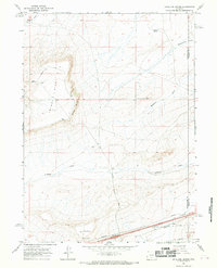
1966 Map of Antelope Spring
USGS Topo · Published 1969About this map
The high desert landscape of Wyoming's Great Divide Basin is meticulously charted here, defined by the prominent Windy Hill and Windy Point rising above the surrounding flats. During the mid-1960s, this area on the Sweetwater and Carbon County line served as a critical corridor for infrastructure and navigation. A Pipeline corridor and the Riner Cutoff Road cross the terrain, while technical landmarks like an Airway Beacon and a Radio Facility reflect the era's reliance on ground-based navigational aids for regional aviation. The drainage patterns of the high plains are clearly visible through features such as Mahoney Draw, Creston Draw, and Buck Draw, which lead toward Separation Flats. This topographical study captures a specific moment of transition when traditional range landmarks like Antelope Spring shared the landscape with modern industrial and transportation systems.
Find a feature on this map
14 named features on this map. Tap any name to fly to it.
Don’t see what you’re looking for? This feature index may not catch every label — zoom into the map to look around manually.
Map Details
Editions of this 1966 Antelope Spring Map
3 editions found
Other maps of this area

1954 · Rawlins
USGS Topo · 1:250,000

1956 · Rawlins Peak
USGS Topo · 1:62,500

1956 · Bridger Pass
USGS Topo · 1:62,500

1958 · Rawlins
USGS Topo · 1:250,000

1960 · Larsen Knoll
USGS Topo · 1:24,000

1960 · Buck Draw
USGS Topo · 1:24,000

1962 · Rawlins
USGS Topo · 1:250,000

1966 · Jawbone Ranch
USGS Topo · 1:24,000

1966 · Creston Junction
USGS Topo · 1:24,000

1966 · Riner
USGS Topo · 1:24,000