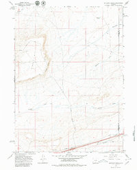
1966 Map of Antelope Spring
USGS Topo · Published 1979About this map
The high desert terrain of the Sweetwater and Carbon county line is defined by the steep escarpment of Windy Hill and its prominent Windy Point. This mid-century survey captures a landscape of transit and resource infrastructure, where the Rinor Road and Cutoff Road navigate the complex topography. The presence of an Airway Beacon and a Radio Facility at the southern edge highlights the area's role in mid-century navigational networks, while multiple pipelines crossing the drainage of Fillmore Creek suggest the industrial development of the era.
Find a feature on this map
17 named features on this map. Tap any name to fly to it.
Don’t see what you’re looking for? This feature index may not catch every label — zoom into the map to look around manually.
Map Details
Editions of this 1966 Antelope Spring Map
3 editions found
Other maps of this area

1954 · Rawlins
USGS Topo · 1:250,000

1956 · Rawlins Peak
USGS Topo · 1:62,500

1956 · Bridger Pass
USGS Topo · 1:62,500

1958 · Rawlins
USGS Topo · 1:250,000

1960 · Larsen Knoll
USGS Topo · 1:24,000

1960 · Buck Draw
USGS Topo · 1:24,000

1962 · Rawlins
USGS Topo · 1:250,000

1966 · Jawbone Ranch
USGS Topo · 1:24,000

1966 · Creston Junction
USGS Topo · 1:24,000

1966 · Riner
USGS Topo · 1:24,000