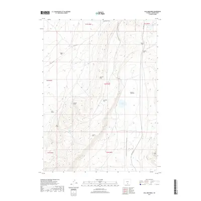
2017 Map of Coal Mine Ridge
USGS Topo · Published 2017About this map
The Continental Divide National Scenic Trail winds through this high-altitude landscape in Carbon County, Wyoming. The terrain is defined by a series of prominent ridges and drainages, including the eponymous Coal Mine Ridge and the Atlantic Rim. Water sources are critical landmarks in this arid environment, represented by named features such as Ninemile Spring, Chicken Pete Spring, and Eightmile Lake.
Find a feature on this map
28 named features on this map. Tap any name to fly to it.
Don’t see what you’re looking for? This feature index may not catch every label — zoom into the map to look around manually.
Map Details
Editions of this 2017 Coal Mine Ridge Map
This is the sole edition of this map. No revisions or reprints were ever made.
Other maps of this area

1953 · Rawlins
USGS Topo · 1:24,000

1954 · Rawlins
USGS Topo · 1:250,000

1956 · Rawlins Peak
USGS Topo · 1:62,500

1956 · Bridger Pass
USGS Topo · 1:62,500

1956 · Bolten Ranch
USGS Topo · 1:62,500

1958 · Rawlins
USGS Topo · 1:250,000

1962 · Rawlins
USGS Topo · 1:250,000

1967 · Rawlins
USGS Topo · 1:250,000
1983 · Coal Mine Ridge
USGS Topo · 1:24,000
1983 · Separation Peak
USGS Topo · 1:24,000