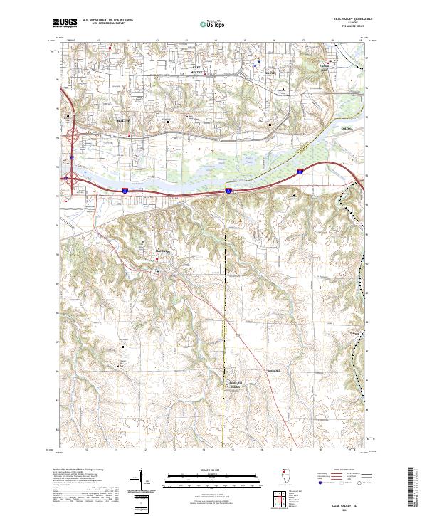
2024 Map of Coal Valley
USGS Topo · Published 2024About this map
Coal Valley and the surrounding urban periphery of the Quad Cities are defined by the convergence of the Rock River and Green River in this modern survey. The landscape transitions from the dense residential and industrial grid of Moline and East Moline in the north to the more open, dissected terrain of southern Rock Island County. Numerous sloughs, such as Coaltown Slough and Bowles Slough, mark the lowlands near the riverbanks, while the southern reaches are characterized by narrow creek valleys like Shaffer Creek and Coal Creek. The map is particularly useful for genealogical research, documenting several burial sites including the Rock Island County Home Cem and the Homestead Cem. Infrastructure dominates the central corridor, where the Quad Cities International Airport sits adjacent to the primary transportation routes connecting Silvis, Colona, and the smaller settlement of Warner.
Find a feature on this map
88 named features on this map. Tap any name to fly to it.
Don’t see what you’re looking for? This feature index may not catch every label — zoom into the map to look around manually.
Map Details
Editions of this 2024 Coal Valley Map
This is the sole edition of this map. No revisions or reprints were ever made.
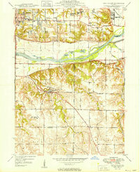
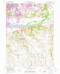
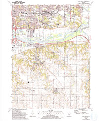
Historical Maps of Poplar Grove Through Time
4 maps found