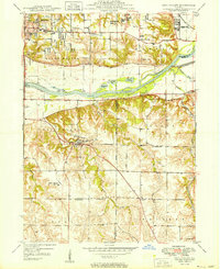
1949 Map of Coal Valley
USGS Topo · Published 1949About this map
Coal Valley and the surrounding river bottomlands are captured here just after World War II, illustrating an era when coal extraction and agriculture coexisted alongside the industrial expansion of Moline. The northern reaches are dominated by the Rock River and the Illinois and Mississippi Canal, where features like the Rock River View Dam and various sloughs—including Coaltown Slough and Greenwood Slough—define the landscape.
Find a feature on this map
45 named features on this map. Tap any name to fly to it.
Don’t see what you’re looking for? This feature index may not catch every label — zoom into the map to look around manually.
Map Details
Editions of this 1949 Coal Valley Map
2 editions found

Other maps of this area

1891 · Davenport
USGS Topo · 1:62,500

1892 · Leclaire
USGS Topo · 1:62,500

1893 · Leclaire
USGS Topo · 1:62,500

1894 · Davenport
USGS Topo · 1:62,500

1899 · Clinton
USGS Topo · 1:125,000

1901 · Rock Island
USGS Topo · 1:125,000

1910 · Rock Island
USGS Topo · 1:125,000

1912 · Milan
USGS Topo · 1:62,500

1937 · Orion
USGS Topo · 1:62,500

1944 · Milan
USGS Topo · 1:62,500