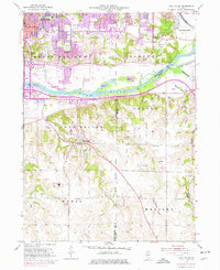
1953 Map of Coal Valley
USGS Topo · Published 1976About this map
Industrial and rural landscapes converge along the Rock River corridor in this mid-century look at the Quad Cities' southeastern edge. The map documents the heavy footprint of the Black Hawk Mine and Gem Mine, highlighting the coal extraction history that gave Coal Valley its name. While urban expansion from Moline and East Moline pushes south, the riverfront maintains specialized transit and recreation sites including the Quad City Seaplane Base and Lock No 29 on the Illinois and Mississippi Canal. In the quieter southern sections, institutional landmarks such as the Oak Glen Nursing Home and the Arrowhead Ranch sit amidst a network of family-named creeks and rural schools like the Kingdom School. The inclusion of a Motorcycle Speed Track south of the primary settlement reflects the evolving recreational character of the valley during the early 1950s.
Find a feature on this map
58 named features on this map. Tap any name to fly to it.
Don’t see what you’re looking for? This feature index may not catch every label — zoom into the map to look around manually.
Map Details
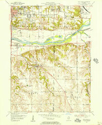
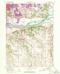
Editions of this 1953 Coal Valley Map
3 editions found
Other maps of this area

1891 · Davenport
USGS Topo · 1:62,500

1892 · Leclaire
USGS Topo · 1:62,500

1893 · Leclaire
USGS Topo · 1:62,500

1894 · Davenport
USGS Topo · 1:62,500

1899 · Clinton
USGS Topo · 1:125,000

1901 · Rock Island
USGS Topo · 1:125,000

1910 · Rock Island
USGS Topo · 1:125,000

1912 · Milan
USGS Topo · 1:62,500

1937 · Orion
USGS Topo · 1:62,500

1944 · Milan
USGS Topo · 1:62,500