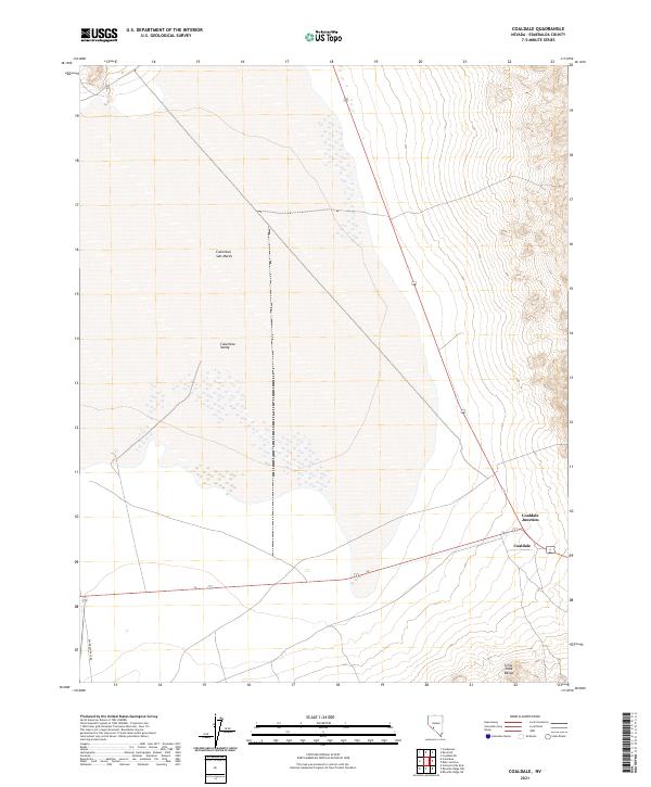
2021 Map of Coaldale
USGS Topo · Published 2021About this map
Columbus Salt Marsh dominates the center of this Esmeralda County landscape, illustrating the terminal drainage patterns of the high desert. The stark white expanse of the salt marsh lies within the Columbia Valley, flanked to the east by the rising contours of the Silver Peak Range. This area serves as a critical transportation corridor where Highway 95 meets the local settlement of Coaldale Junction. The intersection at Coaldale represents a localized hub in an otherwise sparse basin, providing a waypoint for travelers along the historic route now designated as Emigrant Pass Rd. The map detail captures the intersection of desert geology and mid-century transit infrastructure in a region defined by its expansive dry lake beds and isolated mountain spurs.
Find a feature on this map
11 named features on this map. Tap any name to fly to it.
Don’t see what you’re looking for? This feature index may not catch every label — zoom into the map to look around manually.
Map Details
Editions of this 2021 Coaldale Map
This is the sole edition of this map. No revisions or reprints were ever made.
Other maps of this area

1898 · Silver Peak
USGS Topo · 1:125,000

1900 · Silver Peak
USGS Topo · 1:125,000

1907 · Tonopah
USGS Topo · 1:250,000

1908 · Lida
USGS Topo · 1:250,000

1908 · Tonopah
USGS Topo · 1:250,000

1909 · Hawthorne
USGS Topo · 1:250,000

1911 · Hawthorne
USGS Topo · 1:250,000

1913 · Lida
USGS Topo · 1:250,000

1915 · Hawthorne
USGS Topo · 1:250,000

1917 · White Mountain
USGS Topo · 1:125,000