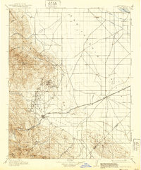
1912 Map of Coalinga
USGS Topo · Published 1939About this map
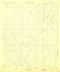
The oil-driven economy of the early twentieth century dominates this landscape, where Oil City and Oilfields sit at the base of Anticline Ridge. As the Southern Pacific railroad reaches the terminal at Alcalde, the map illustrates a region transitioning from raw resource extraction to more settled agriculture. The industrial footprint is evident at the San Joaquin Valley Coal Mine, while the flatter eastern terrain of the San Joaquin Valley shows early irrigation infrastructure through the Stinson Canal and Crescent Canal.
Find a feature on this map
38 named features on this map. Tap any name to fly to it.
Don’t see what you’re looking for? This feature index may not catch every label — zoom into the map to look around manually.
Map Details
Editions of this 1912 Coalinga Map
4 editions found
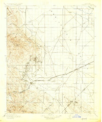
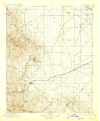
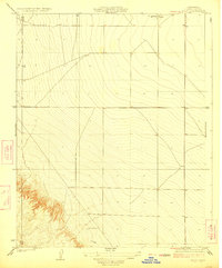
Other maps of this area

1912 · Coalinga
USGS Topo · 1:125,000

1913 · Panoche
USGS Topo · 1:125,000

1914 · Lost Hills
USGS Topo · 1:125,000

1914 · Cholame
USGS Topo · 1:125,000

1915 · Priest Valley
USGS Topo · 1:125,000

1915 · Cholame
USGS Topo · 1:125,000

1917 · Cholame
USGS Topo · 1:125,000

1919 · San Miguel
USGS Topo · 1:62,500
1923 · Levis
USGS Topo · 1:31,680
1923 · Englebrecht Ranch
USGS Topo · 1:31,680