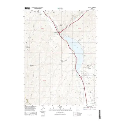
2017 Map of Coalville
USGS Topo · Published 2017About this map
Echo Reservoir dominates the central landscape of this 2017 survey, serving as a focal point for the surrounding canyon and valley topography. The Weber River flows through the area, anchoring the settlements of Henefer, Echo, Coalville, and Hoytsville. This corridor has long served as a vital transit passage, evidenced here by the modern Interstate 80 and the Rail Trail which follows the historic path of the Union Pacific through Echo Canyon.
Find a feature on this map
73 named features on this map. Tap any name to fly to it.
Don’t see what you’re looking for? This feature index may not catch every label — zoom into the map to look around manually.
Map Details
Editions of this 2017 Coalville Map
This is the sole edition of this map. No revisions or reprints were ever made.
Other maps of this area

1885 · Salt Lake
USGS Topo · 1:250,000

1900 · Coalville
USGS Topo · 1:125,000

1903 · Coalville
USGS Topo · 1:125,000

1925 · Ft. Douglas
USGS Topo · 1:125,000

1928 · Ft. Douglas
USGS Topo · 1:125,000

1954 · Salt Lake City
USGS Topo · 1:250,000

1954 · Ogden
USGS Topo · 1:250,000

1958 · Ogden
USGS Topo · 1:250,000

1958 · Salt Lake City
USGS Topo · 1:250,000

1960 · Ogden
USGS Topo · 1:250,000