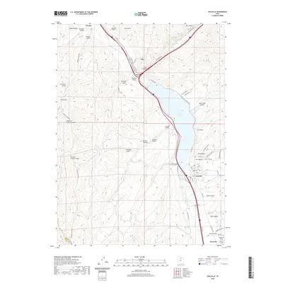
2020 Map of Coalville
USGS Topo · Published 2020About this map
The Weber River corridor serves as the primary axis for this northern Utah landscape, where the settlements of Henefer, Echo, and Coalville are linked by a complex network of transportation and water infrastructure. The massive Echo Reservoir dominates the central terrain, bordered by the Rail Trail and the entrance to the dramatic Echo Canyon. This intersection of geography and industry is further marked by the presence of Witch Rocks and a series of deep canyons like Bromleys Canyon and Narrows Canyon that cut into the Wasatch Range.
Find a feature on this map
68 named features on this map. Tap any name to fly to it.
Don’t see what you’re looking for? This feature index may not catch every label — zoom into the map to look around manually.
Map Details
Editions of this 2020 Coalville Map
This is the sole edition of this map. No revisions or reprints were ever made.
Other maps of this area

1885 · Salt Lake
USGS Topo · 1:250,000

1900 · Coalville
USGS Topo · 1:125,000

1903 · Coalville
USGS Topo · 1:125,000

1925 · Ft. Douglas
USGS Topo · 1:125,000

1928 · Ft. Douglas
USGS Topo · 1:125,000

1954 · Salt Lake City
USGS Topo · 1:250,000

1954 · Ogden
USGS Topo · 1:250,000

1958 · Ogden
USGS Topo · 1:250,000

1958 · Salt Lake City
USGS Topo · 1:250,000

1960 · Ogden
USGS Topo · 1:250,000