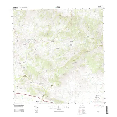
2013 Map of Coamo
USGS Topo · Published 2013About this map
Coamo serves as the focal point of this 2013 landscape, where the urban grid gives way to the complex topography of the Island of Puerto Rico. The settlement pattern follows the drainage of the Rio Coamo, with neighborhoods like Villa Cristina and Mariano Colón established amidst a series of prominent peaks, including Cerro Santa Ana and Cerro de la Mesa. The road network, featuring Avenida Luis Muñoz Marin and Calle HM Towner, reveals the modern expansion of these communities within the steep valleys of the Central Mountain Range.
Find a feature on this map
44 named features on this map. Tap any name to fly to it.
Don’t see what you’re looking for? This feature index may not catch every label — zoom into the map to look around manually.
Map Details
Editions of this 2013 Coamo Map
This is the sole edition of this map. No revisions or reprints were ever made.
Other maps of this area

1944 · Santa Isabel
USGS Topo · 1:30,000

1945 · Rio Descalabrado
USGS Topo · 1:30,000

1945 · Central Aguirre
USGS Topo · 1:30,000

1945 · Salinas
USGS Topo · 1:30,000

1946 · Coamo
USGS Topo · 1:30,000

1946 · Barranquitas
USGS Topo · 1:30,000

1946 · Cayey
USGS Topo · 1:30,000

1946 · Comerio
USGS Topo · 1:30,000

1946 · Orocovis
USGS Topo · 1:30,000

1947 · Cayey NO
USGS Topo · 1:10,000