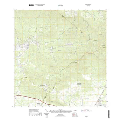
2018 Map of Coamo
USGS Topo · Published 2018About this map
Coamo sits at the heart of this landscape, where the southern foothills meet the Cordillera Central. The town's grid is detailed with residential streets like Cll Ruiz Belvis Norte and Cll Segundo Bernier, centered near the Cementerio Municipal de Coamo. To the south, the modern Autopista Luis A Ferre cuts across the plains near Parcelas Peñuelas, providing a sharp contrast to the winding mountain roads that lead toward the highlands of Pastos.
Find a feature on this map
56 named features on this map. Tap any name to fly to it.
Don’t see what you’re looking for? This feature index may not catch every label — zoom into the map to look around manually.
Map Details
Editions of this 2018 Coamo Map
This is the sole edition of this map. No revisions or reprints were ever made.
Other maps of this area

1944 · Santa Isabel
USGS Topo · 1:30,000

1945 · Rio Descalabrado
USGS Topo · 1:30,000

1945 · Central Aguirre
USGS Topo · 1:30,000

1945 · Salinas
USGS Topo · 1:30,000

1946 · Coamo
USGS Topo · 1:30,000

1946 · Barranquitas
USGS Topo · 1:30,000

1946 · Cayey
USGS Topo · 1:30,000

1946 · Comerio
USGS Topo · 1:30,000

1946 · Orocovis
USGS Topo · 1:30,000

1947 · Cayey NO
USGS Topo · 1:10,000