
1946 Map of Coamo
USGS Topo · Published 1946About this map
Coamo serves as the focal point of this mid-1940s landscape, positioned where the historic Carretera Central winds through the southern foothills of the Cordillera Central. The map documents a predominantly agricultural economy, evidenced by several prominent estates including Hacienda Lago, Hacienda Esmeralda, Colonia Peñuelas, and Hacienda San José. These named haciendas and colonies highlight the land-use patterns of the era, situated near water sources like the Río Coamo and Río Cuyón.
Find a feature on this map
37 named features on this map. Tap any name to fly to it.
Don’t see what you’re looking for? This feature index may not catch every label — zoom into the map to look around manually.
Map Details
Editions of this 1946 Coamo Map
This is the sole edition of this map. No revisions or reprints were ever made.
Other maps of this area

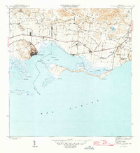
1944 · Santa Isabel
USGS Topo · 1:30,000

1945 · Rio Descalabrado
USGS Topo · 1:30,000
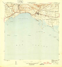
1945 · Central Aguirre
USGS Topo · 1:30,000
1945 · Salinas
USGS Topo · 1:30,000

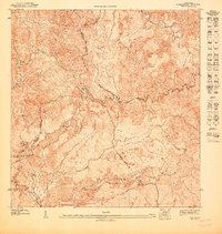
1946 · Barranquitas
USGS Topo · 1:30,000

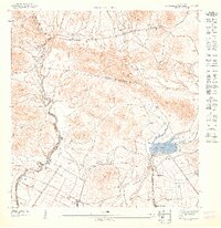
1946 · Cayey
USGS Topo · 1:30,000

1946 · Comerio
USGS Topo · 1:30,000

1946 · Orocovis
USGS Topo · 1:30,000
1947 · Cayey NO
USGS Topo · 1:10,000
1947 · Rio Descalabrado SE
USGS Topo · 1:10,000