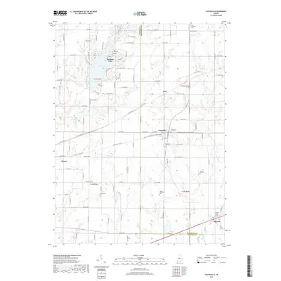
2019 Map of Coatesville
USGS Topo · Published 2019About this map
Coatesville serves as the central hub of this west-central Indiana landscape, straddling the line between Putnam and Hendricks counties. The area is defined by its small crossroads settlements and a network of rural routes, including the planned community surrounding Heritage Lake and the village of Reno. For genealogists, the map is particularly dense with burial grounds, ranging from the West Branch Friends Cem and Moravian Cem to the Hebron Presbyterian Cem near Sunset Lake. The drainage pattern is led by Mill Cr and its tributaries like Crittenden Cr and Deer Cr, which carve through the farmland. From the Oleo Airport in the north to the historic village of Stilesville in the southeast, the map documents a stable agricultural region where legacy farmstead names and small-town footprints remain the primary landmarks of the countryside.
Find a feature on this map
76 named features on this map. Tap any name to fly to it.
Don’t see what you’re looking for? This feature index may not catch every label — zoom into the map to look around manually.
Map Details
Editions of this 2019 Coatesville Map
This is the sole edition of this map. No revisions or reprints were ever made.
Other maps of this area

1953 · Clayton
USGS Topo · 1:24,000

1953 · Danville
USGS Topo · 1:24,000

1953 · Indianapolis
USGS Topo · 1:250,000

1955 · Hall
USGS Topo · 1:24,000

1956 · Indianapolis
USGS Topo · 1:250,000

1956 · Cloverdale
USGS Topo · 1:24,000

1956 · Eminence
USGS Topo · 1:24,000

1957 · Indianapolis
USGS Topo · 1:250,000

1958 · Roachdale
USGS Topo · 1:24,000

1958 · Coatesville
USGS Topo · 1:24,000