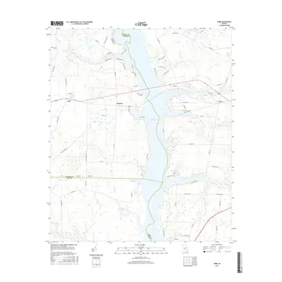
2017 Map of Cobb
USGS Topo · Published 2017About this map
Lake Blackshear serves as the central geographic feature of this South Georgia landscape, where the borders of Sumter, Crisp, and Lee Counties converge. The settlement of Cobb sits to the west, linked to the eastern shore and Coney by a primary roadway crossing the reservoir. The map reveals a transition from the structured residential street patterns of Flintside, characterized by roads like Ferry Rd and Flintside Dr, to the more expansive agricultural and wetland areas to the south. Along the western edge, numerous small water bodies and drainage systems, such as Gill Pace Lake and Spring Cr, dot the terrain. Further south, the landscape becomes increasingly hydrologically complex with features like Wheatley Lake North and Lower Wheatley Lake, illustrating the managed water levels and natural drainage basins that define this portion of the Flint River basin.
Find a feature on this map
82 named features on this map. Tap any name to fly to it.
Don’t see what you’re looking for? This feature index may not catch every label — zoom into the map to look around manually.
Map Details
Editions of this 2017 Cobb Map
This is the sole edition of this map. No revisions or reprints were ever made.
Other maps of this area

1953 · Dothan
USGS Topo · 1:250,000

1953 · Waycross
USGS Topo · 1:250,000

1954 · Dothan
USGS Topo · 1:250,000

1955 · Dothan
USGS Topo · 1:250,000

1955 · Phenix City
USGS Topo · 1:250,000

1956 · Leslie
USGS Topo · 1:62,500

1957 · Phenix City
USGS Topo · 1:250,000

1957 · Macon
USGS Topo · 1:250,000

1958 · Macon
USGS Topo · 1:250,000

1958 · Phenix City
USGS Topo · 1:250,000