
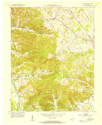
1953 Map of Cobb
USGS Topo · Published 1954About this map
The Muddy Fork Little River meanders through the heart of this Western Kentucky landscape, carving deep loops as it flows south toward its confluence with the Little River. In the early 1950s, this area along the Caldwell Co Trigg Co line was defined by small agricultural settlements and rural infrastructure. The Illinois Central railroad serves the community of Cobb in the north, while the village of Wallonia sits at a prominent bend in the Muddy Fork. Local life is anchored by country churches and cemeteries, including Blue Spring Ch and the Rocky Ridge Sch. Water resources are central to the region, from the engineered Hopson Lake and Hammond Lake to natural landmarks like Martin Spring and Millwood Creek.
Find a feature on this map
26 named features on this map. Tap any name to fly to it.
Don’t see what you’re looking for? This feature index may not catch every label — zoom into the map to look around manually.
Map Details
Editions of this 1953 Cobb Map
This is the sole edition of this map. No revisions or reprints were ever made.
Other maps of this area

1908 · Princeton
USGS Topo · 1:62,500

1909 · Dawson Springs
USGS Topo · 1:48,000

1910 · Princeton
USGS Topo · 1:62,500

1911 · Dawson Springs
USGS Topo · 1:62,500

1950 · Caledonia
USGS Topo · 1:24,000

1951 · Caledonia
USGS Topo · 1:24,000

1953 · Canton
USGS Topo · 1:24,000

1953 · Gracey
USGS Topo · 1:24,000

1953 · Dawson Springs SW
USGS Topo · 1:24,000
1953 · Lamasco
USGS Topo · 1:24,000