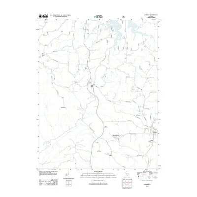
2012 Map of Cobden
USGS Topo · Published 2012About this map
The fruit-growing and clay-mining landscape of southern Illinois is documented in this 2012 survey, centered on the historic rail town of Cobden. The map follows the dramatic elevation changes of the Shawnee Hills, rising from Clear Cr to the prominent peak of Bald Knob. Along the ridge, Alto Pass serves as a key local hub, while the small community of Kaolin reflects the area's geological history of clay extraction. Several small family cemeteries are preserved across the quadrangle, including Hagler Cem, Stearns Cem, and Mount Tabor Cem, offering points of interest for genealogists tracking early settlers. The complex network of rural roads and water features like Cedar Lake and the Alto Pass Reservoir illustrate the modern intersection of recreational development and traditional agricultural settlement patterns in Union County.
Find a feature on this map
70 named features on this map. Tap any name to fly to it.
Don’t see what you’re looking for? This feature index may not catch every label — zoom into the map to look around manually.
Map Details
Editions of this 2012 Cobden Map
This is the sole edition of this map. No revisions or reprints were ever made.
Other maps of this area

1920 · Jonesboro
USGS Topo · 1:62,500

1920 · Dongola
USGS Topo · 1:62,500

1922 · Carbondale
USGS Topo · 1:62,500

1923 · Dongola
USGS Topo · 1:62,500

1923 · Jonesboro
USGS Topo · 1:62,500

1924 · Alto Pass
USGS Topo · 1:62,500

1941 · Carbondale
USGS Topo · 1:62,500

1947 · Jonesboro
USGS Topo · 1:62,500

1947 · Alto Pass
USGS Topo · 1:62,500

1947 · Gorham
USGS Topo · 1:24,000