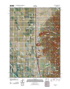
2011 Map of Coburg
USGS Topo · Published 2011About this map
Coburg serves as the primary hub of this landscape, situated just east of the Willamette River and its associated waterways like Mill Slough and Cartwright Slough. The map reveals a complex drainage system defined by Muddy Creek and its many branches, including Dry Muddy Creek and Little Muddy Creek, which wind through the flatlands below the rising elevations of West Point Hill and Rock Hill.
Find a feature on this map
58 named features on this map. Tap any name to fly to it.
Don’t see what you’re looking for? This feature index may not catch every label — zoom into the map to look around manually.
Map Details
Editions of this 2011 Coburg Map
This is the sole edition of this map. No revisions or reprints were ever made.
Other maps of this area

1909 · Harrisburg
USGS Topo · 1:31,680

1909 · Rowland
USGS Topo · 1:31,680

1910 · Eugene
USGS Topo · 1:62,500

1912 · Halsey
USGS Topo · 1:62,500

1921 · Brownsville
USGS Topo · 1:62,500

1940 · Eugene
USGS Topo · 1:62,500

1941 · Halsey
USGS Topo · 1:62,500

1946 · Eugene
USGS Topo · 1:62,500

1949 · Eugene
USGS Topo · 1:62,500

1950 · Marcola
USGS Topo · 1:62,500