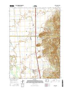
2017 Map of Coburg
USGS Topo · Published 2017About this map
The city of Coburg serves as the focal point of this 2017 study, situated at the base of the Coburg Hills where the valley floor meets the rising terrain. The map documents a landscape defined by complex water systems, including the Willamette River and various sloughs and creeks such as Mill Slough, Spring Cr, and Cartwright Slough. Evidence of local aviation is present at Greer Airport and West Point Airport, while the West Point Cem offers a grounded connection for genealogists researching the area's early residents. Prominent landforms like Centennial Butte, W Point Hill, and Lenon Hill rise above the surrounding agricultural fields and the Linn and Lane county line, marking the transition from the flatlands to the eastern highlands.
Find a feature on this map
63 named features on this map. Tap any name to fly to it.
Don’t see what you’re looking for? This feature index may not catch every label — zoom into the map to look around manually.
Map Details
Editions of this 2017 Coburg Map
This is the sole edition of this map. No revisions or reprints were ever made.
Other maps of this area

1909 · Harrisburg
USGS Topo · 1:31,680

1909 · Rowland
USGS Topo · 1:31,680

1910 · Eugene
USGS Topo · 1:62,500

1912 · Halsey
USGS Topo · 1:62,500

1921 · Brownsville
USGS Topo · 1:62,500

1940 · Eugene
USGS Topo · 1:62,500

1941 · Halsey
USGS Topo · 1:62,500

1946 · Eugene
USGS Topo · 1:62,500

1949 · Eugene
USGS Topo · 1:62,500

1950 · Marcola
USGS Topo · 1:62,500