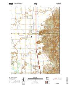
2020 Map of Coburg
USGS Topo · Published 2020About this map
Coburg sits at the foot of the Coburg Hills, marking a transition between the valley floor and the rising uplands of the t16s r3w township. The landscape is defined by its complex drainage systems, where the Willamette River and various sloughs like Mill Slough and Gartwright Slough intersect with numerous creeks, including Muddy Cr and Camas Cr. These watercourses likely influenced early agricultural patterns and settlement siting, creating a fertile but potentially flood-prone environment.
Find a feature on this map
66 named features on this map. Tap any name to fly to it.
Don’t see what you’re looking for? This feature index may not catch every label — zoom into the map to look around manually.
Map Details
Editions of this 2020 Coburg Map
This is the sole edition of this map. No revisions or reprints were ever made.
Other maps of this area

1909 · Harrisburg
USGS Topo · 1:31,680

1909 · Rowland
USGS Topo · 1:31,680

1910 · Eugene
USGS Topo · 1:62,500

1912 · Halsey
USGS Topo · 1:62,500

1921 · Brownsville
USGS Topo · 1:62,500

1940 · Eugene
USGS Topo · 1:62,500

1941 · Halsey
USGS Topo · 1:62,500

1946 · Eugene
USGS Topo · 1:62,500

1949 · Eugene
USGS Topo · 1:62,500

1950 · Marcola
USGS Topo · 1:62,500