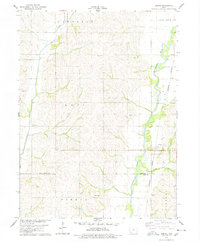
1978 Map of Coburg
USGS Topo · Published 1978About this map
The East Nishnabotna River carves a significant valley through the eastern portion of this southwestern Iowa landscape, where the Burlington Northern railroad follows the water's edge. The small settlement of Coburg serves as a primary point of interest along the rail line, while the community of Climax is situated further west. This area reflects a traditional agricultural settlement pattern, with family and community history anchored at sites like Salem Cem, Walnut Cem, and Franklin Cem. Numerous tributaries, including Walnut Creek, Ashby Creek, and Romp Creek, define the drainage of the upland territory. These waterways and the established rail corridor illustrate the historical reliance on natural topography for transport and transit in the late 1970s. The presence of a Gravel Pit near the river suggests localized resource extraction supporting the region's infrastructure.
Find a feature on this map
18 named features on this map. Tap any name to fly to it.
Don’t see what you’re looking for? This feature index may not catch every label — zoom into the map to look around manually.
Map Details
Editions of this 1978 Coburg Map
This is the sole edition of this map. No revisions or reprints were ever made.
Other maps of this area

1954 · Omaha
USGS Topo · 1:250,000

1955 · Nebraska City
USGS Topo · 1:250,000

1957 · Nebraska City
USGS Topo · 1:250,000

1957 · Omaha
USGS Topo · 1:250,000

1958 · Omaha
USGS Topo · 1:250,000

1958 · Nebraska City
USGS Topo · 1:250,000

1978 · Shenandoah East
USGS Topo · 1:24,000
1978 · Emerson
USGS Topo · 1:24,000

1978 · Stanton SW
USGS Topo · 1:24,000

1978 · Wales
USGS Topo · 1:24,000