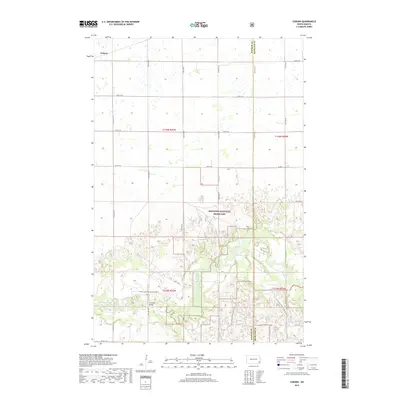
2018 Map of Coburn
USGS Topo · Published 2018About this map
Coburn sits at the northern edge of this landscape, characterized by the expansive protected lands of the Sheyenne National Grassland. The southern half of the map is dominated by the winding course of the Sheyenne River, which carves a distinct valley through the prairie. This riparian corridor serves as a focal point for local landmarks and infrastructure, including the Ylvisaker Bridge and a section of the N Country National Scenic Trail. Cultural history is anchored by the Owego Lutheran Church Cemetery located near the riverbank. The section lines and gravel roads, such as Co Rd 2, illustrate a grid-based settlement pattern typical of the North Dakota plains, where small communities and church sites provided vital social hubs for scattered homesteads.
Find a feature on this map
26 named features on this map. Tap any name to fly to it.
Don’t see what you’re looking for? This feature index may not catch every label — zoom into the map to look around manually.
Map Details
Editions of this 2018 Coburn Map
This is the sole edition of this map. No revisions or reprints were ever made.
Other maps of this area

1895 · Casselton
USGS Topo · 1:125,000

1897 · Casselton
USGS Topo · 1:125,000

1907 · Wyndmere
USGS Topo · 1:125,000

1953 · Fargo
USGS Topo · 1:250,000

1956 · Fargo
USGS Topo · 1:250,000

1959 · Leonard
USGS Topo · 1:24,000

1960 · Power
USGS Topo · 1:24,000

1960 · Wyndmere NW
USGS Topo · 1:24,000

1960 · Coburn
USGS Topo · 1:24,000

1960 · Venlo
USGS Topo · 1:24,000