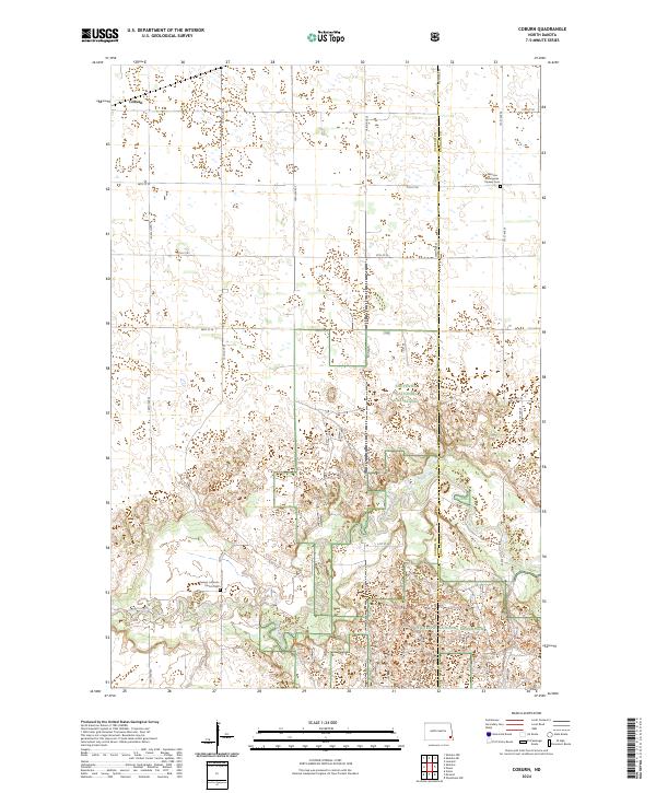
2024 Map of Coburn
USGS Topo · Published 2024About this map
Sheyenne National Grassland dominates the southern half of this landscape, where the winding course of the Sheyenne River cuts through the prairie. In the northern sections, the terrain transitions into the organized grid of agricultural sections typical of southeastern North Dakota. Family and congregational history is rooted in the presence of the Owego Lutheran Church Cem and the Johnson Vangsnes Pioneer Cem, both of which serve as landmarks of the early regional settlement. The small community of Coburn sits near the northwestern corner of the quadrangle along the rail line, while the boundary between Ransom Co and Richland Co bisects the eastern portion of the sheet. This map reveals a specialized environment where protected grasslands meet traditional plains farming, separated by the distinct riparian corridor of the river valley.
Find a feature on this map
19 named features on this map. Tap any name to fly to it.
Don’t see what you’re looking for? This feature index may not catch every label — zoom into the map to look around manually.
Map Details
Editions of this 2024 Coburn Map
This is the sole edition of this map. No revisions or reprints were ever made.
Other maps of this area

1895 · Casselton
USGS Topo · 1:125,000

1897 · Casselton
USGS Topo · 1:125,000

1907 · Wyndmere
USGS Topo · 1:125,000

1953 · Fargo
USGS Topo · 1:250,000

1956 · Fargo
USGS Topo · 1:250,000

1959 · Leonard
USGS Topo · 1:24,000

1960 · Power
USGS Topo · 1:24,000

1960 · Wyndmere NW
USGS Topo · 1:24,000

1960 · Coburn
USGS Topo · 1:24,000

1960 · Venlo
USGS Topo · 1:24,000