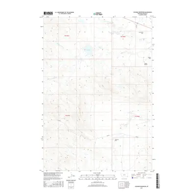
2017 Map of Cochran Reservoir
USGS Topo · Published 2017About this map
Cochran Reservoir anchors this landscape in Carter County, Montana, where the hydrology of the Willow Creek system branches across open rangeland. The drainage patterns are defined by the N Fork Willow Cr, Middle Fork Willow Cr, and S Fork Willow Cr, creating a complex network of seasonal watercourses and topographic depressions. Named landforms such as Zimmerman Draw, Nelson Draw, and Torgerson Draw provide evidence of historical land use and family-named landmarks in this corner of the Big Sky State. The terrain is notably etched by the Nelson Washout, illustrating the erosive character of the local geography. Transportation is limited to functional backcountry routes like Ridge Rd and Pilster Dr, which follow the section lines and natural contours of the high plains, reflecting the area's sparse settlement and focus on large-scale grazing operations.
Find a feature on this map
15 named features on this map. Tap any name to fly to it.
Don’t see what you’re looking for? This feature index may not catch every label — zoom into the map to look around manually.
Map Details
Editions of this 2017 Cochran Reservoir Map
This is the sole edition of this map. No revisions or reprints were ever made.
Other maps of this area

1905 · Devils Tower
USGS Topo · 1:125,000

1954 · Ekalaka
USGS Topo · 1:250,000

1954 · Gillette
USGS Topo · 1:250,000

1955 · Gillette
USGS Topo · 1:250,000

1956 · Ekalaka
USGS Topo · 1:250,000

1957 · Seely
USGS Topo · 1:62,500

1957 · Cedar Ridge
USGS Topo · 1:62,500

1958 · Gillette
USGS Topo · 1:250,000

1958 · Ekalaka
USGS Topo · 1:250,000

1962 · Gillette
USGS Topo · 1:250,000