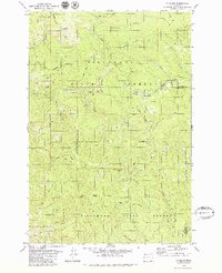
1979 Map of Cochran
USGS Topo · Published 1980About this map
Cochran stands as a focal point within the Tillamook State Forest, situated along the Southern Pacific railroad line where it skirts the South Fork Nehalem River. This 1970s landscape is defined by the intersection of industrial transport and the drainage networks of the Salmonberry River and the Nehalem River. The map detail reveals the infrastructure of a working timberland, with borrow pits and numerous logging grades like Standard Grade and Storey Burn Road carving through the steep elevations of Salmonberry Mountain and Larch Mountain.
Find a feature on this map
34 named features on this map. Tap any name to fly to it.
Don’t see what you’re looking for? This feature index may not catch every label — zoom into the map to look around manually.
Map Details
Editions of this 1979 Cochran Map
2 editions found
Other maps of this area

1937 · Enright
USGS Topo · 1:62,500

1939 · Saddle Mountain
USGS Topo · 1:62,500

1941 · Keasey
USGS Topo · 1:62,500

1941 · Timber
USGS Topo · 1:62,500

1941 · Enright
USGS Topo · 1:62,500

1943 · Keasey
USGS Topo · 1:62,500

1943 · Saddle Mtn.
USGS Topo · 1:62,500

1948 · Vancouver
USGS Topo · 1:250,000

1950 · Vancouver
USGS Topo · 1:250,000

1950 · Vancouver
USGS Topo · 1:250,000