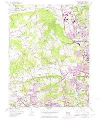
1957 Map of Cockeysville
USGS Topo · Published 1976About this map
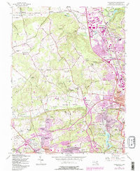
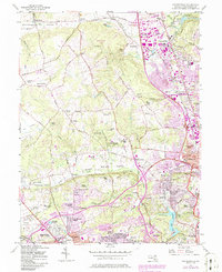
Cockeysville and Lutherville anchor this mid-century portrait of suburban Baltimore County, showing a landscape in transition as residential developments like Canterbury Estates and Long Meadows Estates began to fill the spaces between established rural communities. The map highlights a concentration of institutions that define the area's social fabric, including the Maryvale Prep Sch, St Pauls Sch, and the Sacred Heart Monastery. Transport infrastructure is prominent, featuring the Baltimore-Harrisburg Expressway and the Penn Central rail line cutting through the valley. This era also shows the cultural leisure of the time, with numerous golf courses such as Five Farms Golf Course and Woodholme Golf Course scattered across the undulating terrain of Chestnut Ridge. To the east, the edge of the Loch Raven Reservoir and the State Fairgrounds near Timonium mark significant regional landmarks that remain central to the county's identity today.
Find a feature on this map
95 named features on this map. Tap any name to fly to it.
Don’t see what you’re looking for? This feature index may not catch every label — zoom into the map to look around manually.
Map Details
Editions of this 1957 Cockeysville Map
6 editions found
Other maps of this area

1892 · Ellicott
USGS Topo · 1:62,500

1894 · Ellicott
USGS Topo · 1:62,500

1894 · Baltimore
USGS Topo · 1:62,500

1899 · Baltimore
USGS Topo · 1:62,500

1900 · Parkton
USGS Topo · 1:62,500

1902 · Parkton
USGS Topo · 1:62,500

1904 · Baltimore
USGS Topo · 1:62,500

1905 · Westminster
USGS Topo · 1:62,500

1906 · Ellicott
USGS Topo · 1:62,500

1908 · Patapsco
USGS Topo · 1:125,000