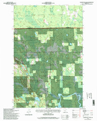
1996 Map of Coddington Lake
USGS Topo · Published 1998About this map
The Big Fork River and Black Duck River dominate this Northern Minnesota landscape, where the convergence of major state and federal forest boundaries creates a patchwork of protected wilderness. This 1996 survey records the intersection of the Chippewa National Forest, Pine Island State Forest, and Big Fork State Forest near the Itasca and Koochiching county line. Cultural markers are sparse in this wetland-heavy terrain, but the Grafton Cemetery stands as a significant point of local heritage. The map details the hydrology of Coddington Lake and the marshy expanses of Dishpan, including the Dish Pan Wildlife Management Area. Researchers will note the balance of industry and conservation, with several Gravel Pits located near the river systems and primitive water access points like the Boat Access (No Ramp) on the Big Fork.
Find a feature on this map
15 named features on this map. Tap any name to fly to it.
Don’t see what you’re looking for? This feature index may not catch every label — zoom into the map to look around manually.
Map Details
Editions of this 1996 Coddington Lake Map
This is the sole edition of this map. No revisions or reprints were ever made.
Other maps of this area

1918 · Zora
USGS Topo · 1:62,500

1919 · Zora
USGS Topo · 1:62,500

1919 · Gemmell
USGS Topo · 1:62,500

1919 · Max
USGS Topo · 1:62,500

1954 · Bemidji
USGS Topo · 1:250,000

1954 · Hibbing
USGS Topo · 1:250,000

1957 · Bemidji
USGS Topo · 1:250,000

1957 · Hibbing
USGS Topo · 1:250,000

1958 · Bemidji
USGS Topo · 1:250,000

1958 · Hibbing
USGS Topo · 1:250,000