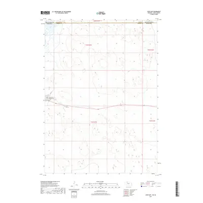
2017 Map of Cody East
USGS Topo · Published 2017About this map
The village of Cody sits at the southern edge of this landscape, just below the state line where South Dakota and Nebraska meet. This 2017 survey details the transition from the structured street grid of the town, including Washington St and Nebraska Ave, to the expansive wetlands and dune topography of the north. To the east of the settlement, Prairie Lawn Cem serves as a significant local landmark for genealogical research. The northern portion of the map is dominated by the hydrology of the Sandhills, featuring Cody Lake and the winding course of Hay Cr. This boundary area highlights the sparse settlement patterns where Bennett and Cherry counties intersect, reflecting a region defined by its water resources and township divisions like t35n r33w.
Find a feature on this map
18 named features on this map. Tap any name to fly to it.
Don’t see what you’re looking for? This feature index may not catch every label — zoom into the map to look around manually.
Map Details
Editions of this 2017 Cody East Map
This is the sole edition of this map. No revisions or reprints were ever made.
Other maps of this area

1950 · Cody
USGS Topo · 1:62,500

1952 · Eli
USGS Topo · 1:62,500

1955 · Martin
USGS Topo · 1:250,000

1957 · Valentine
USGS Topo · 1:250,000

1958 · Martin
USGS Topo · 1:250,000

1959 · Valentine
USGS Topo · 1:250,000

1969 · Spring Creek SW
USGS Topo · 1:24,000

1969 · Spring Creek
USGS Topo · 1:24,000

1981 · Scotchman Lake
USGS Topo · 1:25,000

1983 · Martin
USGS Topo · 1:100,000