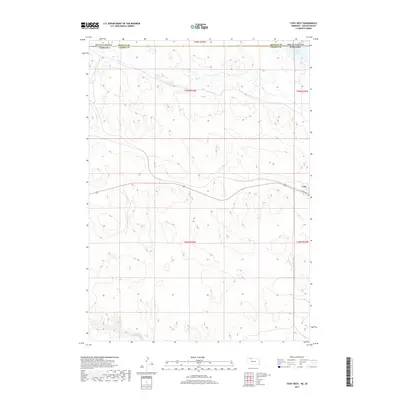
2017 Map of Cody West
USGS Topo · Published 2017About this map
Cody serves as the primary focal point of this 2017 survey, situated near the eastern edge of the quadrangle along Cody Ave. The map documents the border between South Dakota and Nebraska, illustrating the transition between Bennett County and Cherry County. The landscape is defined by its water systems, including the southward flowing Hay Creek which feeds into the larger wetland areas near Cody Lake. To the south, the terrain descends toward the Niobrara River, with Bear Creek drainage cutting through the southern townships. The map provides a detailed view of the section lines and township boundaries, including t35n r34w, which organize this sparsely populated ranching and agricultural region during the early 21st century.
Find a feature on this map
12 named features on this map. Tap any name to fly to it.
Don’t see what you’re looking for? This feature index may not catch every label — zoom into the map to look around manually.
Map Details
Editions of this 2017 Cody West Map
This is the sole edition of this map. No revisions or reprints were ever made.
Other maps of this area

1950 · Cody
USGS Topo · 1:62,500

1952 · Eli
USGS Topo · 1:62,500

1955 · Martin
USGS Topo · 1:250,000

1957 · Valentine
USGS Topo · 1:250,000

1958 · Martin
USGS Topo · 1:250,000

1959 · Valentine
USGS Topo · 1:250,000

1969 · Spring Creek SW
USGS Topo · 1:24,000

1981 · Scotchman Lake
USGS Topo · 1:25,000

1983 · Martin
USGS Topo · 1:100,000

1985 · Eli SE
USGS Topo · 1:24,000