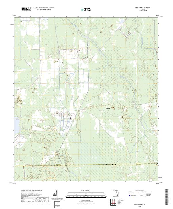
2024 Map of Codys Corner
USGS Topo · Published 2024About this map
Codys Corner and the surrounding pine flatwoods of Flagler County are characterized by a network of drainage ways and rural intersections that have defined the landscape for generations. This modern survey illustrates the persistence of small settlements such as Deanville and Relay, which sit amongst a vast hydrographic system dominated by Middle Haw Creek and Little Haw Creek. The map documents the northern reaches of the Heart Island Conservation Area, where the terrain transitions toward Lake Disston. While the area around Bunnell shows more established roadway development, much of the quadrangle remains a low-lying mosaic of wetlands and timberland, with historical movement patterns preserved in routes like Co RD 305 and the winding Heart Island Conservation Area Trl. The presence of Sweetwater Br and various county roads indicates a rural economy still deeply tied to the natural watercourses of the Florida interior.
Find a feature on this map
28 named features on this map. Tap any name to fly to it.
Don’t see what you’re looking for? This feature index may not catch every label — zoom into the map to look around manually.
Map Details
Editions of this 2024 Codys Corner Map
This is the sole edition of this map. No revisions or reprints were ever made.
Other maps of this area

1937 · Ormond
USGS Topo · 1:48,000

1944 · Ormond
USGS Topo · 1:62,500

1954 · Daytona Beach
USGS Topo · 1:250,000

1956 · Favoretta
USGS Topo · 1:24,000

1956 · Flagler Beach West
USGS Topo · 1:24,000

1958 · Daytona Beach
USGS Topo · 1:250,000

1962 · Daytona Beach NW
USGS Topo · 1:24,000

1964 · Daytona Beach
USGS Topo · 1:250,000

1970 · Seville
USGS Topo · 1:24,000
1970 · Bunnell
USGS Topo · 1:24,000