
1906 Map of Coeur D'Alene District
USGS Topo · Published 1906About this map
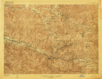
Mining operations dominate the landscape of the Shoshone County silver valley at the start of the 20th century. Major industrial centers like Wallace, Kellogg, and Mullan serve as hubs for the surrounding mountains, which are densely packed with underground workings. The northern part of the district around Murray and Delta shows the earlier gold-focused history of the region, while the canyon between Gem and Burke is a tight corridor of heavy industry, including the Hecla Mine and Standard-Mammoth Mine. Transport is defined by the competing interests of the Oregon Railroad & Navigation Co. and the Northern Pacific Railway, which follow the river forks to reach lucrative properties like the Bunker Hill and Sullivan Mines. Engineering feats of the era are evident in the Kellogg Tunnel and the Daisy Aerial Tramway, marking a period of intense extraction and technological growth.
Find a feature on this map
205 named features on this map. Tap any name to fly to it.
Don’t see what you’re looking for? This feature index may not catch every label — zoom into the map to look around manually.
Map Details
Editions of this 1906 Coeur D'Alene District Map
3 editions found
Other maps of this area

1901 · Coeur D'Alene District
USGS Topo · 1:62,500

1903 · Coeur D'Alene District
USGS Topo · 1:62,500

1909 · Cataldo
USGS Topo · 1:125,000

1911 · Cataldo
USGS Topo · 1:125,000

1914 · Avery
USGS Topo · 1:125,000

1917 · Avery
USGS Topo · 1:125,000

1932 · Trout Creek
USGS Topo · 1:125,000

1935 · Trout Creek
USGS Topo · 1:125,000

1936 · Trout Creek
USGS Topo · 1:125,000

1955 · Spokane
USGS Topo · 1:250,000